Continue my journey of exploration.
This time, I am exploring path planning based on the Gaode Map API, and then calculating the time and distance spent from the starting point to the end point, and performing spatial visualization expression. The entire idea is quite simple, although it took a bit of a detour, the result is still feasible.
Welcome to leave messages and exchange ideas.
Keep going.
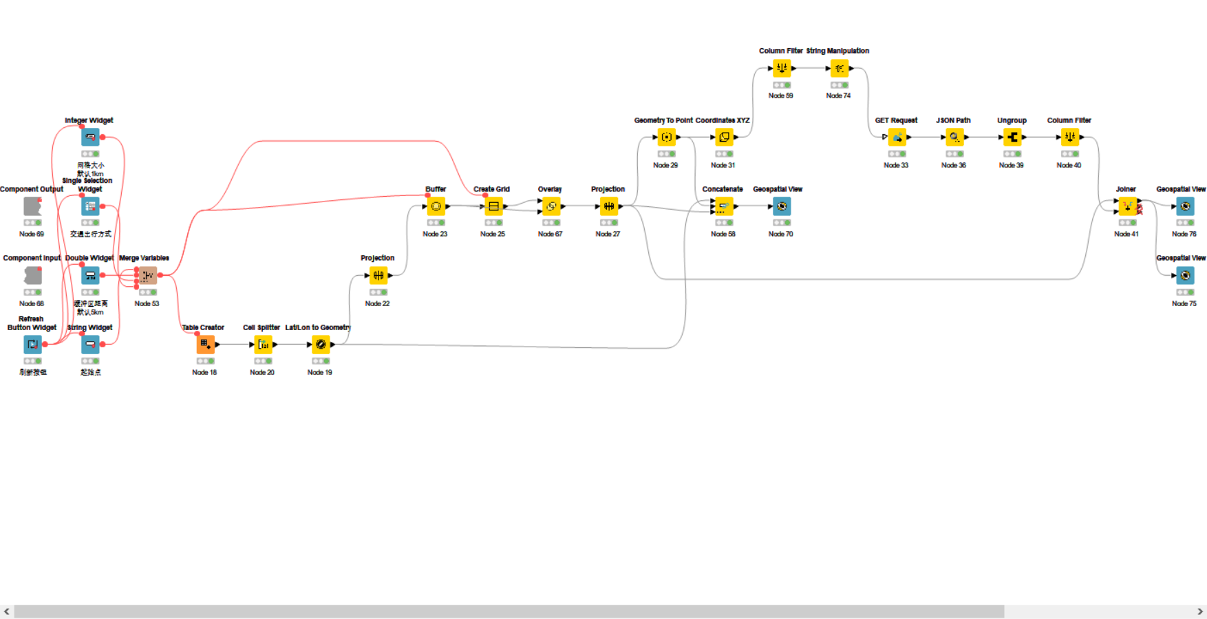
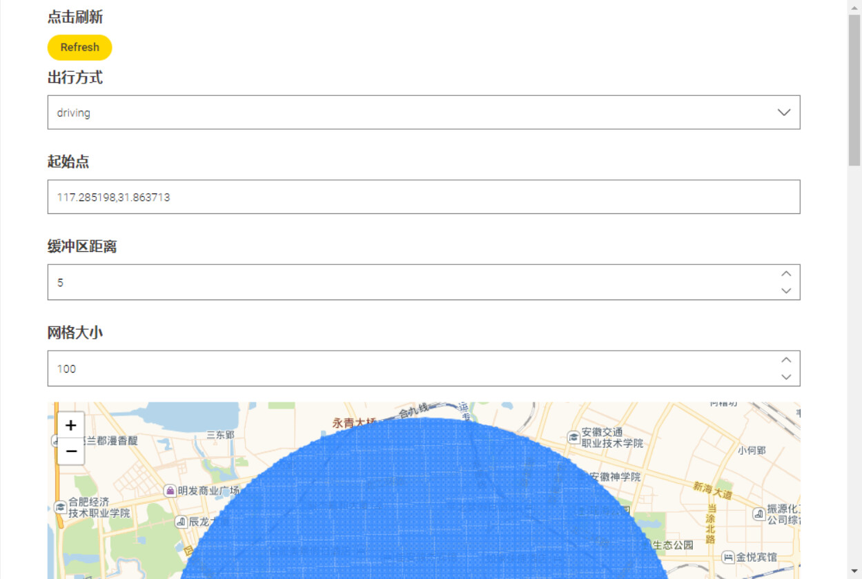
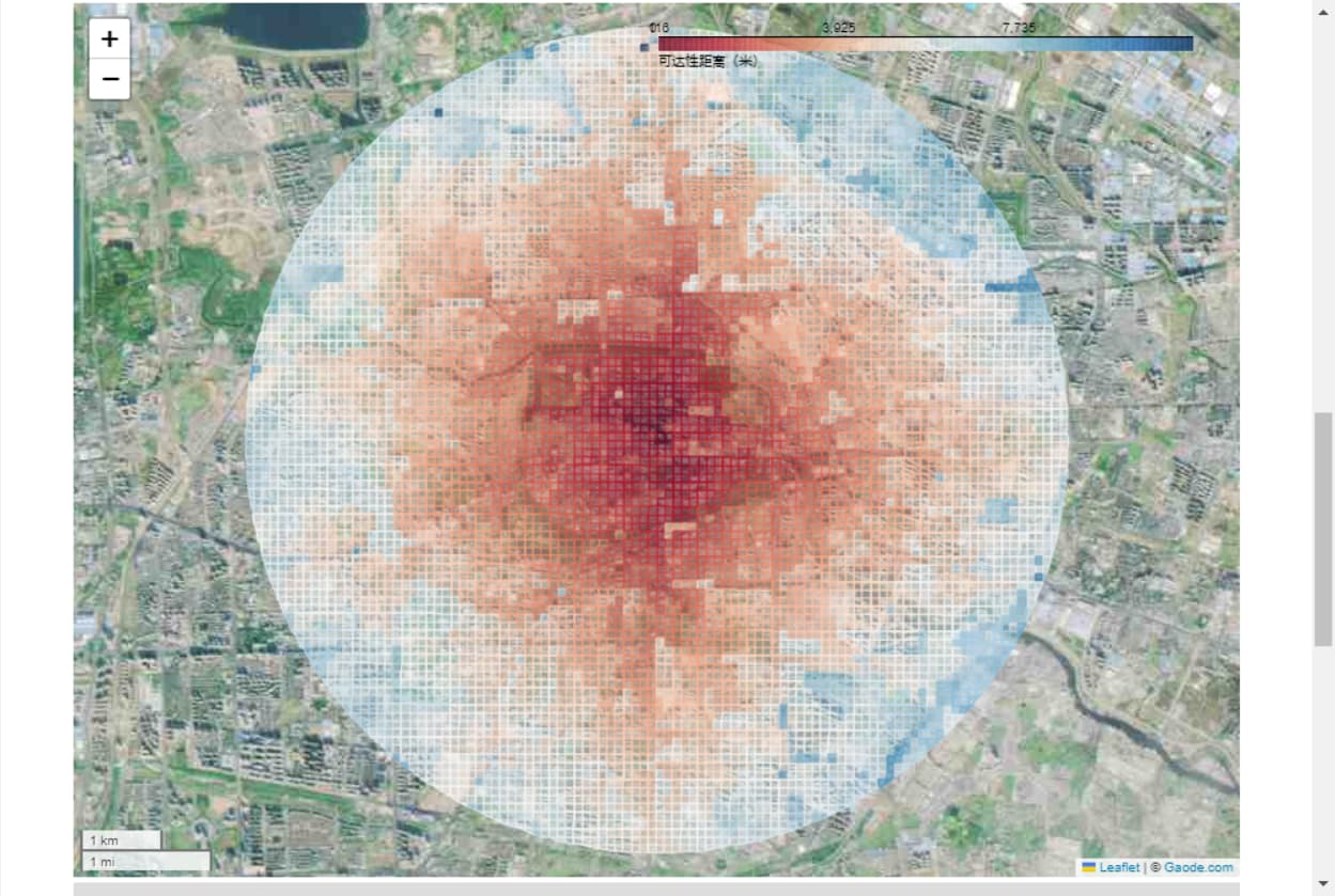
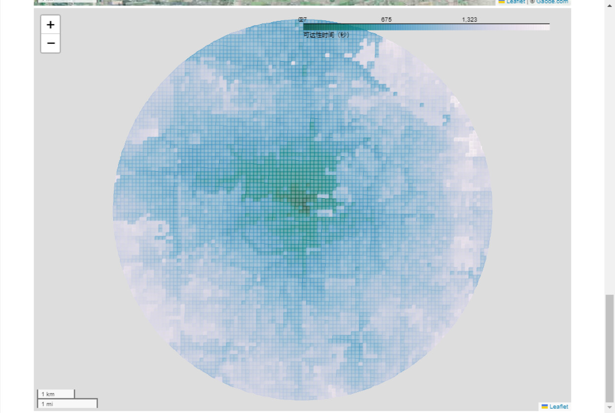
With the help of KNIME geospatial analytics, not a single line of code has been written, and parameterized design, repeatable operation, zero code, and timely display of results have been achieved. Anyway, I really like KNIME geospatial analytics.