Hi,
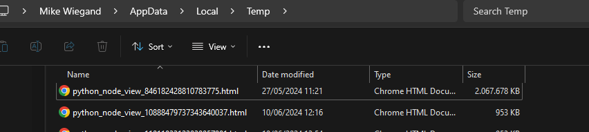
while checking about an issue for thee Community Hacking Days I noticed a humongous HTML file “python_node_view_846182428810783775.html”
Getting the first 100 lines made me realize it’s likely caused by the Geospatial View. One issue I recalled, which required to cancel computation and restart / kill Knime, was that a table contained multiple (>1000) and identical GeoJSON data cells.
Since then these nodes were reseet and optimized or even got deleted, yet the temp data still exists.
Get-Content -Path "C:\Users\Mike Wiegand\AppData\Local\Temp\python_node_view_846182428810783775.html" -TotalCount 100 <!DOCTYPE html> <html> <head> <meta http-equiv="content-type" content="text/html; charset=UTF-8" /> <script> L_NO_TOUCH = false; L_DISABLE_3D = false; </script> <style>html, body {width: 100%;height: 100%;margin: 0;padding: 0;}</style> <style>#map {position:absolute;top:0;bottom:0;right:0;left:0;}</style> <script src="./libs/leaflet/1.9.3/leaflet.js"></script> <script src="./libs/leaflet/1.9.3/jquery-1.12.4.min.js"></script> <script src="./libs/leaflet/1.9.3/bootstrap.bundle.min.js"></script> <script src="./libs/leaflet/1.9.3/leaflet.awesome-markers.js"></script> <link rel="stylesheet" href="./libs/leaflet/1.9.3/leaflet.css"/> <link rel="stylesheet" href="./libs/leaflet/1.9.3/bootstrap.min.css"/> <link rel="stylesheet" href="./libs/leaflet/1.9.3/bootstrap.min.css"/> <link rel="stylesheet" href="./libs/leaflet/1.9.3/all.min.css"/> <link rel="stylesheet" href="./libs/leaflet/1.9.3/leaflet.awesome-markers.css"/> <link rel="stylesheet" href="./libs/leaflet/1.9.3/leaflet.awesome.rotate.min.css"/> <meta name="viewport" content="width=device-width, initial-scale=1.0, maximum-scale=1.0, user-scalable=no" /> <style> #map_e68e18c95dfdbf11dc2236b02c3fcedc { position: relative; width: 100.0%; height: 100.0%; left: 0.0%; top: 0.0%; } .leaflet-container { font-size: 1rem; } </style> <style> .foliumtooltip { } .foliumtooltip table{ margin: auto; } .foliumtooltip tr{ text-align: left; } .foliumtooltip th{ padding: 2px; padding-right: 8px; } </style> <style> .foliumpopup { margin: auto; } .foliumpopup table{ margin: auto; } .foliumpopup tr{ text-align: left; } .foliumpopup th{ padding: 2px; padding-right: 8px; } </style> </head> <body> <div class="folium-map" id="map_e68e18c95dfdbf11dc2236b02c3fcedc" ></div> </body> <script> var map_e68e18c95dfdbf11dc2236b02c3fcedc = L.map( "map_e68e18c95dfdbf11dc2236b02c3fcedc", { center: [-3.1674436999999998, 0.0], crs: L.CRS.EPSG3857, zoom: 10, zoomControl: true, preferCanvas: false, } ); L.control.scale().addTo(map_e68e18c95dfdbf11dc2236b02c3fcedc); var tile_layer_01707a6eddc48d42019c864234cb62ac = L.tileLayer( "https://{s}.tile.openstreetmap.org/{z}/{x}/{y}.png", {"attribution": "Data by \u0026copy; \u003ca target=\"_blank\" href=\"http://openstreetmap.org\"\u003eOpenStreetMap\u003c/a\u003e, under \u003ca target=\"_blank\" href=\"http://www.openstreetmap.org/copyright\"\u003eODbL\u003c/a\u003e.", "detectRetina": false, "maxNativeZoom": 18, "maxZoom": 18, "minZoom": 0, "noWrap": false, "opacity": 1, "subdomains": "abc", "tms": false} ).addTo(map_e68e18c95dfdbf11dc2236b02c3fcedc);
Best
Mike