kimv4
November 5, 2025, 9:04am
1
Hi.
I’m semiconductor enginner.
I want to make a program that calculates how much I have to move to a specific coordinate using the pixel coordinate data of the image.
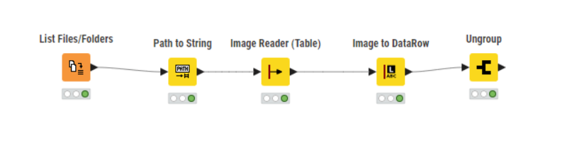
First of all, it is possible to read images.
However, I don’t know how to use pixel coordinate data.
Is there a node that can use pixel coordinate data?
Hi,
can you tell more about the things you want to achieve? Find specific objects in the image or process user input?
In general it’s possible to load and process images in KNIME.
Here’s an example on how to train a classifier using KNIME.
Building an image classification application in KNIME
Andreas
1 Like
kimv4
November 6, 2025, 1:18am
3
Hi.
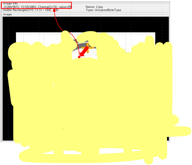
For example, the purpose is to know how much movement is needed to move from A(10, 20) to B(43, 45) in an image.
I think I should use pixel coordinate data, but I don’t know how to use it.
Thank you.
Hmm,
kimv4
November 6, 2025, 8:53am
5
I want to use pixel coordinate data that is checked through the image reader node.
First of all, I want to create a flow that derives how much coordinate movement is needed for the yellow cross marker (A) to get to the B position.