Hello,
I’m very new to Knime, i have a file with lat/long columns and have another shapefile and i want to intersect both files (get points that are within the polygons), i tried the “Coordinate Row Filter” Node but i keep getting following error: 'Execute failed: side location conflict [ (33.62435308887576, -116.53174342604913, NaN) ]"
Thanks.
Hi @ETAMHAZ and welcome to the forum.
Could you perhaps post a workflow with some sample data? It looks like you’ve got some non-numeric data in the results (NaN) so it would be useful to see where that’s coming from.
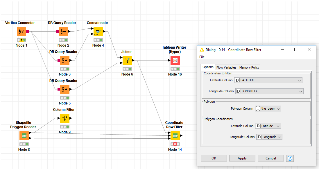
is the snapshot is enough? or please let know what exact data do you want me to share, and thanks a lot for responding.
It would be best to share a toy dataset (post Joiner, along with a Shapefile or two) to demonstrate the problem. But I understand if your data is confidential that may not be possible.
In that case, is it possible to recreate the workflow with a very small public dataset and share it?
attached are the lat/long file and shapefile, Thanks
BTW is there away to read other Spatial formats? like Mif or Tab files (Mapinfo files)?
LatLong.xlsx (397.9 KB)
SHP.zip (21.8 KB)
Thanks for uploading the files. I tried them out and am getting the same error you are.
I’m not a GIS expert, but are you sure that your topology is valid? When I google around, I see this problem pop up when folks have invalid topologies (things like self-intersecting polygons, for example).
when i do the intersect using tableau, it does works perfectly,
do you know if i can read another spatial format beside shapefile? MIF or TAB file,
Thanks.
Not that I know of with KNIME nodes, but that may just be because I’m not a GIS pro.
I suspect there is probably a way to read such files using R or Python.
Thanks a lot Scott for your efforts.
This topic was automatically closed 182 days after the last reply. New replies are no longer allowed.