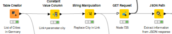
I have set up the following Workflow with the goal to map locations:
In the Table Creator I wrote down a couple of cities as examples and the workflow runs through.
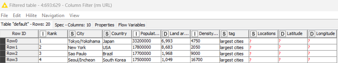
My final list has about 2.800 cities - do you have any experience until how many given locations the GET request runs?
I tried it with all and it stopped really quick (error).
In the end, I want to visualize the map with the OSM Map View Node and for that I am trying to extract the latitude and longtitude.
Here is the configuration of the Regex Extractor which is not working.
When I put in: \b[“location” : {“lat” : ]+[0-9]{2,}+.+[0-p{15}]\b
it has an output, but the results are not always the right ones - sometimes it catches the longitute instead. What am I missing to catch both?
I am happy about answers to all the questions or some of them - thank you!
Full location: knime://EXAMPLES/Users/knime/Examples/03_Visualization/04_Geolocation/06_Google_Geocode_API-OSM-text_file
Back-up:
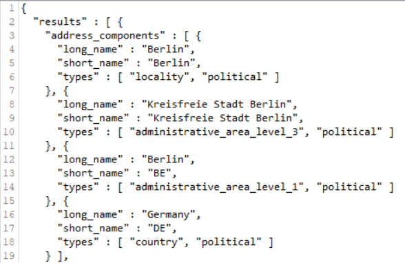
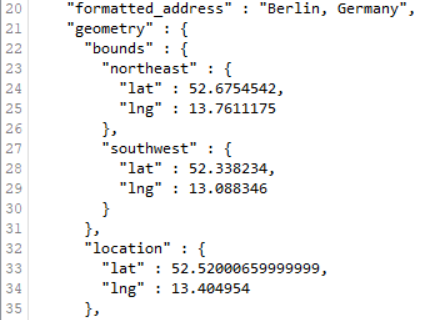
This should help you further with the correct JSON Path. If this doesn’t solve the problem, please upload your JSON body so other people can work with it. It’s a bit too much to type over from a screenshot.
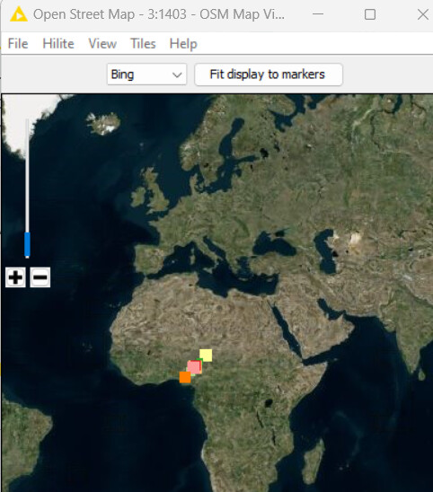
I executed the OSM Map and my points are somewhere in Africa, but should be all in Germany. The Latitudes and Longtitudes should be fine (checked them manually on Google Maps).
Looking at the result of the example workflow if realized that it doens´t show any points on the map. Also the result table before (String Manipulations and Column Filter of the Metanode) don´t show any result.