Hey,
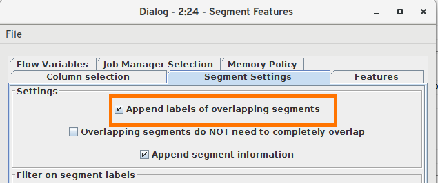
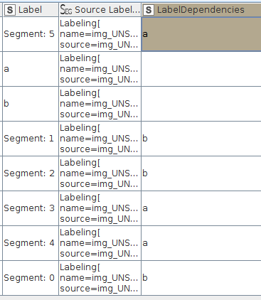
I’m trying to make a workflow for labeling objects in images using the “Interactive Annotator”-node with a “Segment Features”-node following. All labeled boxes are completely separate and may appear multiple times in an image, e.g. creating boxes for each individual cat and dog in an image. Afterwards I would like to get the box-coordinates of all individual boxes. When I check the “Add unique segment id as label”-box, the labels of all objects after the first one are lost (replaced by “Segment ‘#’”), if i uncheck the box, all the boxes of a class are merged together. How can I get the coordinates for all the boxes WITHOUT losing the labeling information?
Thanks