I have list of bird observations with geographic coordinates (longitude/latitude) in the town Ulm in Germany. I want to filter this list to include those collected within an nature protection area using the geographic coordinates. I thought I could use "Geo-Coordinate Row Filter for this purpose. But how can I retrieve the boundaries of the nature protection area as a polygon to filter the data? I failed to retrieve the boundaries using “OSM Boundary Map” node. Is there a way to retrieve that data using this node or any other node? (I am able to see the nature protection area „Lichternsee“ in Open Street Map). Many thanks in advance, Andreas
Hi Andreas,
welcome to the KNIME community.
Do you have the coordinates for the boundaries of the protection area? If yes this post might help.
2 Likes
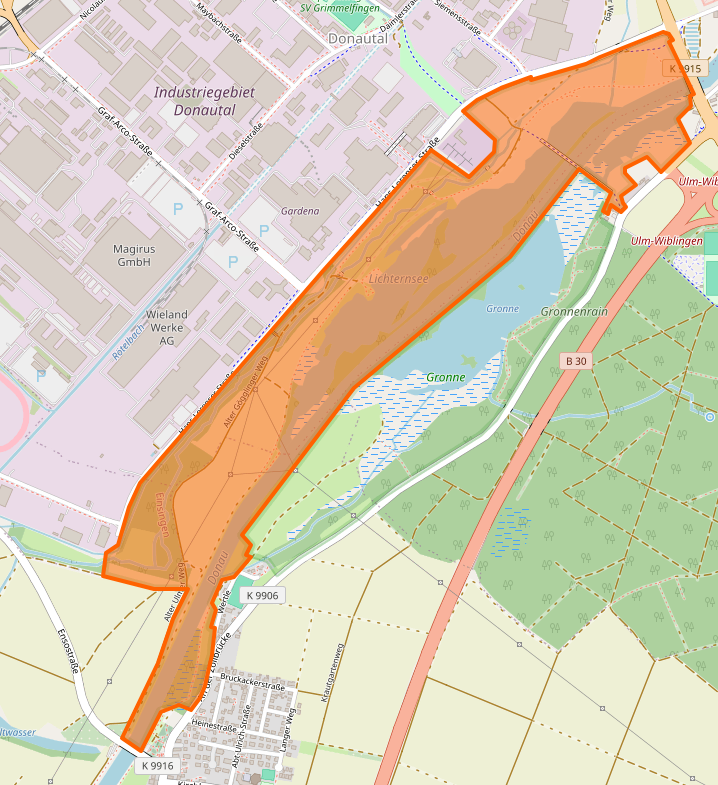
Dear Andreas.
Thanks for your post.
No, I don not have the coordinates of the boundaries of the protection area. That is exactly what I am looking for in order to filter my data. In OpenStreet Map I can see the Naturschutzgebiet “Lichternsee” (see the attached screenshot) however but I failed to get a similiar picture in the “OSM Boundary Map” node. My hope was that I could use this node to retrieve the boundaries of the Naturschutzgebiet.
I have been using KNIME in my job and also to analyze my bird observations but the geospatial data analysis (and its language) in KNIME is completely new to me.
Best regards
Andreas
This topic was automatically closed 90 days after the last reply. New replies are no longer allowed.