Can anyone explain to me what the function of Node Projections and Node Buffers are in geospatial extensions?
Hi @wisnupo -
Let me tag @tobias.koetter to see if he can give some perspective.
Hello @wisnupo ,
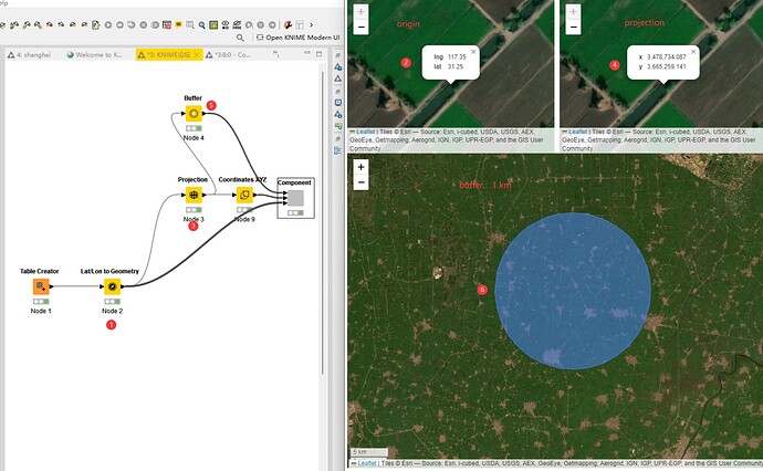
the Projection node allows you to change how the three dimensional earth is projected onto a two dimensional map and influences various properties such as area, distance and direction. For more details see the Projection chapter of the Practitioner’s guide to geospatial analytics.
The Buffer node allows you to create a buffer around a geospatial location e.g. to restrict the search area around a certain point (example flow1 and example flow2) .
For more examples check out the Geospatial Analytics Example space or the Geospatial Collection on the KNIME Community Hub.
Bye
Tobias
This topic was automatically closed 90 days after the last reply. New replies are no longer allowed.
