This is my first time posting to Just KNIME it.
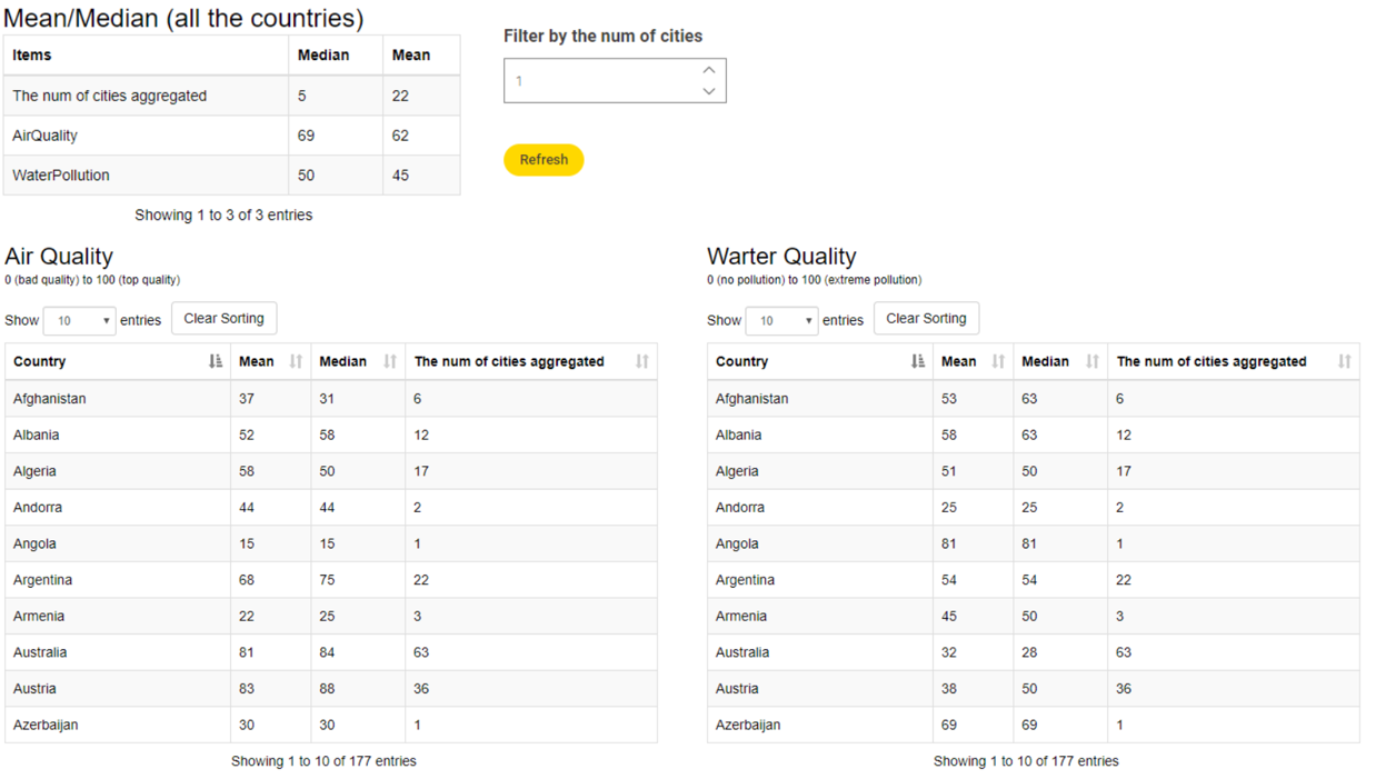
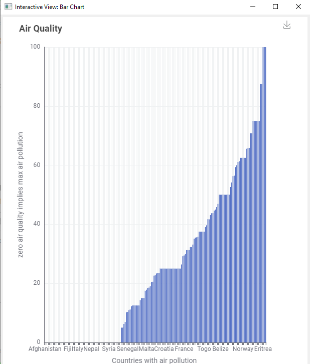
Sort buttons on the column header can be used to sort the countries by median/mean, showing top 10 countries.
The integer input window is for setting a lower limit of the number of cities.
5 Likes
Hey @l6fader, could you upload your workflow to your public space on KNIME Hub and link it here? I’d be happy to download it and try to reproduce this error on my machine and see if I can get a proper solution for it. Thanks!
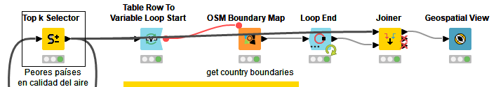
Embarrassingly, this is the unmodified workflow (Task 3) from Rosaria, Roberto and Elisabeth’s blog on the topic:
when i drag/drop the WF into my freshly installed 4.7, this error is the result. ![]()
i was wondering if the issue could be related to the fact that i have multiple installs of KNIME on my machine. but alas, i want to get this challenge done so i will work with another solution… and come back to the geospacial nodes soon.
thank you!
1 Like
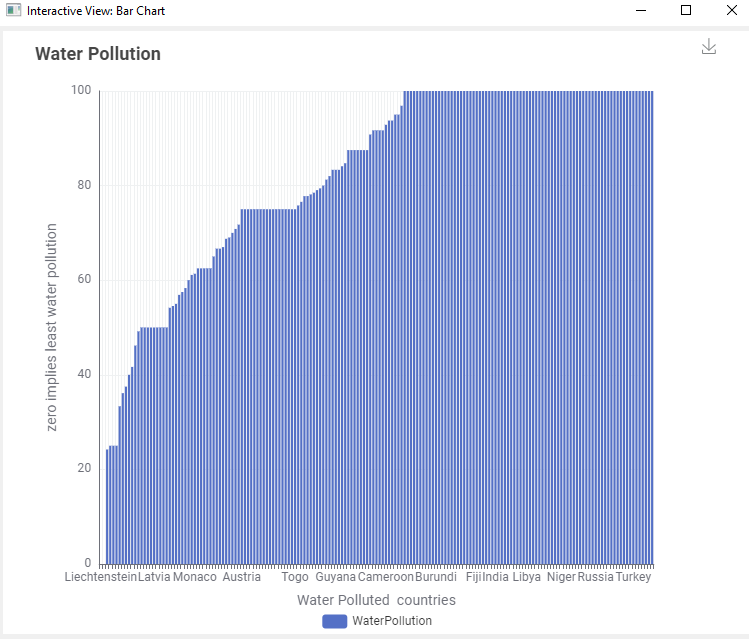
Finally, here is my solution, right under the wire. Went with custom Plotly Chloropleth map since I have implemented this before.
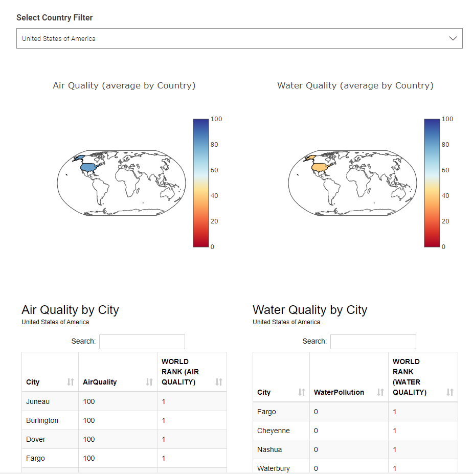
The data app first displays two maps showing Air and Water quality as country averages:
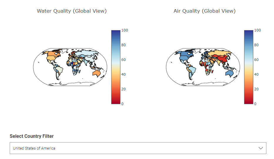
Then you are able to filter by country to get a new map (maybe not so important) and a table with cities within that country and their global rankings.
This one was fun, but i look forward to figuring out the KNIME nodes for Geospatial stuff…
L
4 Likes
Hello people,
I were a lot busy, and I saw many did excellent solutions, I don’t know if the problem needs to implement graphical solutions, someones with maps, other only plots and other do not implement any visual features to enrich the result, I share some solutions for this easy challenge:
- In this JKISeason2-5 ver 1.0 – KNIME Community Hub flow, only use the simple segmentation using the mean over the records about the pollution in water and air, and count cities reported in each country
3 Likes
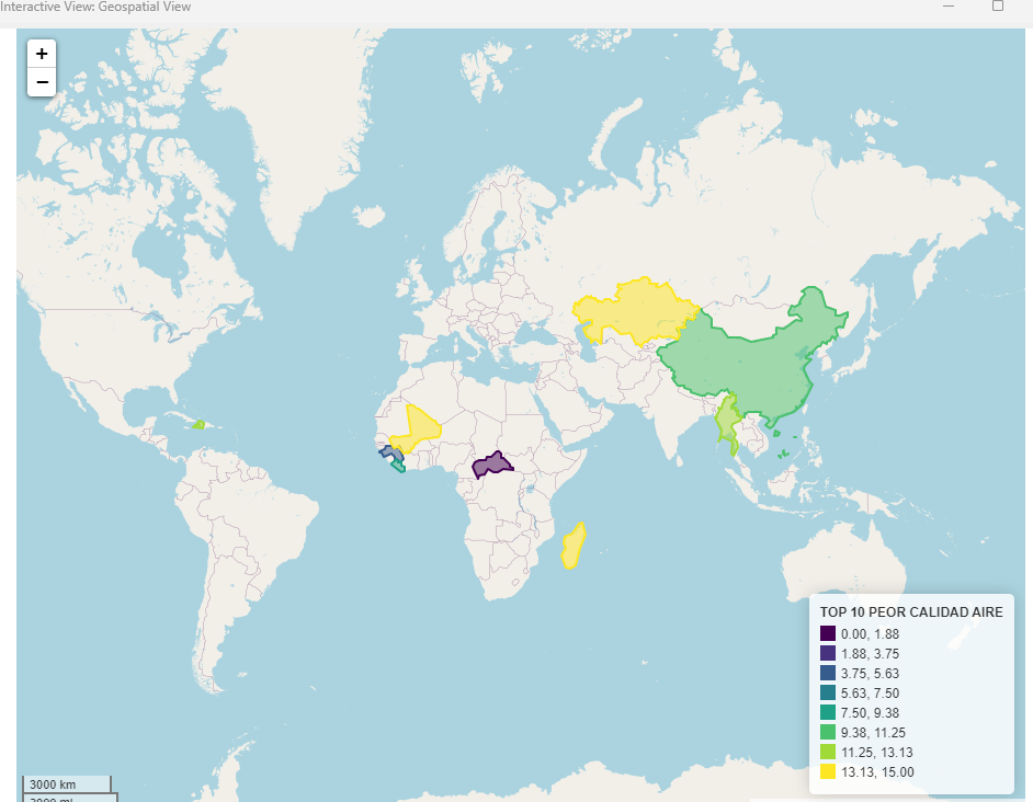
- In this version: JKISeason2-5 ver 1.1 – KNIME Community Hub, not only show the 10 countries with pollution problems, here take in maid the 10 top highest or lowest pollution index and using this point, the final result increase the number of countries that report cities with pollution problems in water and air
1 Like
- In this flow: JKISeason2-5 ver 1.2 – KNIME Community Hub, show all the cities than have pollution on air or water.
1 Like
Hi folks! As always on Tuesdays, here’s the solution to last week’s challenge! ![]()
Our solution is much simpler than some of the ones y’all posted here! ![]() Thank you so much for going the extra mile! We hope you enjoyed this easy challenge and had fun letting your creativity run free
Thank you so much for going the extra mile! We hope you enjoyed this easy challenge and had fun letting your creativity run free ![]() with the visualizations!
with the visualizations!
See you tomorrow for a new challenge!
4 Likes
We’ll look into it very soon, @l6fader! Thanks for the feedback.
Hi @l6fader, thanks for reading our tutorial and trying out our workflows. ![]()
"[WinError 5] Access is denied: ‘cache’ " is a problem with read-only KNIME Analytics Platform KNIME Executor installations which will be fixed with version 1.1 of this extension. For details see here: OSM nodes (OSM Boundary Map) create cache folder in KNIME installation folder which fails for read-only installations · Issue #107 · spatial-data-lab/knime-geospatial-extension · GitHub.
However, if you run the KNIME Executor installation as an admin (given that the admin has write permission on the KNIME Execution installation folder), you should have no issues running the workflow and using the nodes.
Hope it helps. Happy KNIMEing! ![]()
Roberto
1 Like
I have been playing a little more with this Challenge, I have used the geospatial node of Cambridge (a friend ![]() recommended it to me in the last Grupo de Estudio
recommended it to me in the last Grupo de Estudio ![]()
The possibilities are infinite. I have been very impressed with the powerful tool, and I´ll use it a lot in the future.
3 Likes
It works! Thanks @roberto_cadili !
3 Likes
Hello @l6fader, sorry for the delayed response.
The problem normally is present if you have installed POSGis.
The installation of POSGis creates an environment variable that affects the geocoding functions.
Then so it is necessary to uninstall the POSGis
2 Likes
This topic was automatically closed 90 days after the last reply. New replies are no longer allowed.