Solutions to "Just KNIME It!" Challenge 17 - Season 3

:bird: A little birdie told us that a new Just KNIME It! challenge just came out! :eyes: :bird: This week, we’re looking into bird migration data. What patterns can you identify?

Here is the challenge. Let’s use this thread to post our solutions to it, which should be uploaded to your public KNIME Hub spaces with tag JKISeason3-17.

:sos: Need help with tags? To add tag JKISeason3-17 to your workflow, go to the description panel in KNIME Analytics Platform, click the pencil to edit it, and you will see the option for adding tags right there. :slight_smile: Let us know if you have any problems!

2 Likes

My solution to the challange:

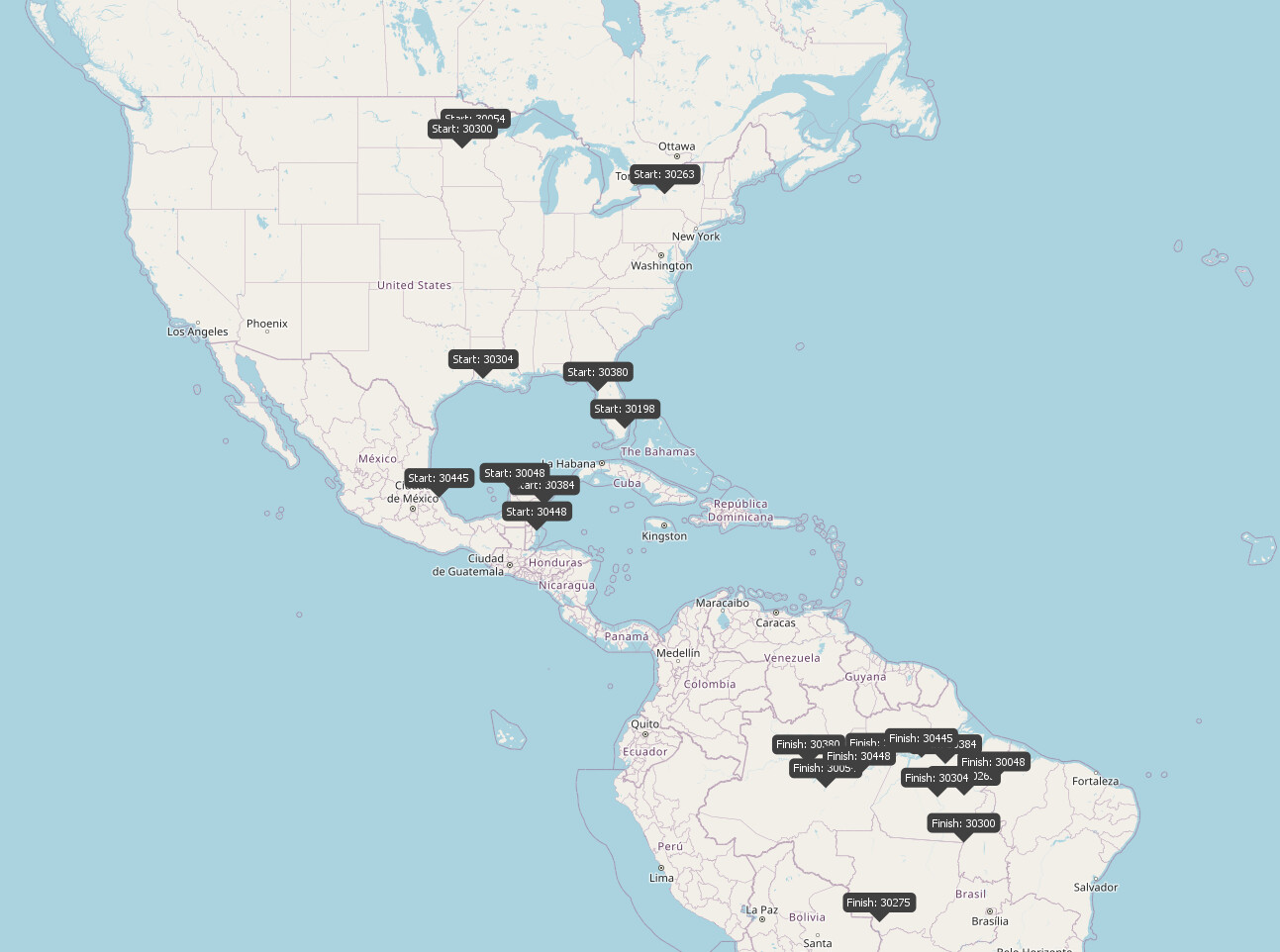
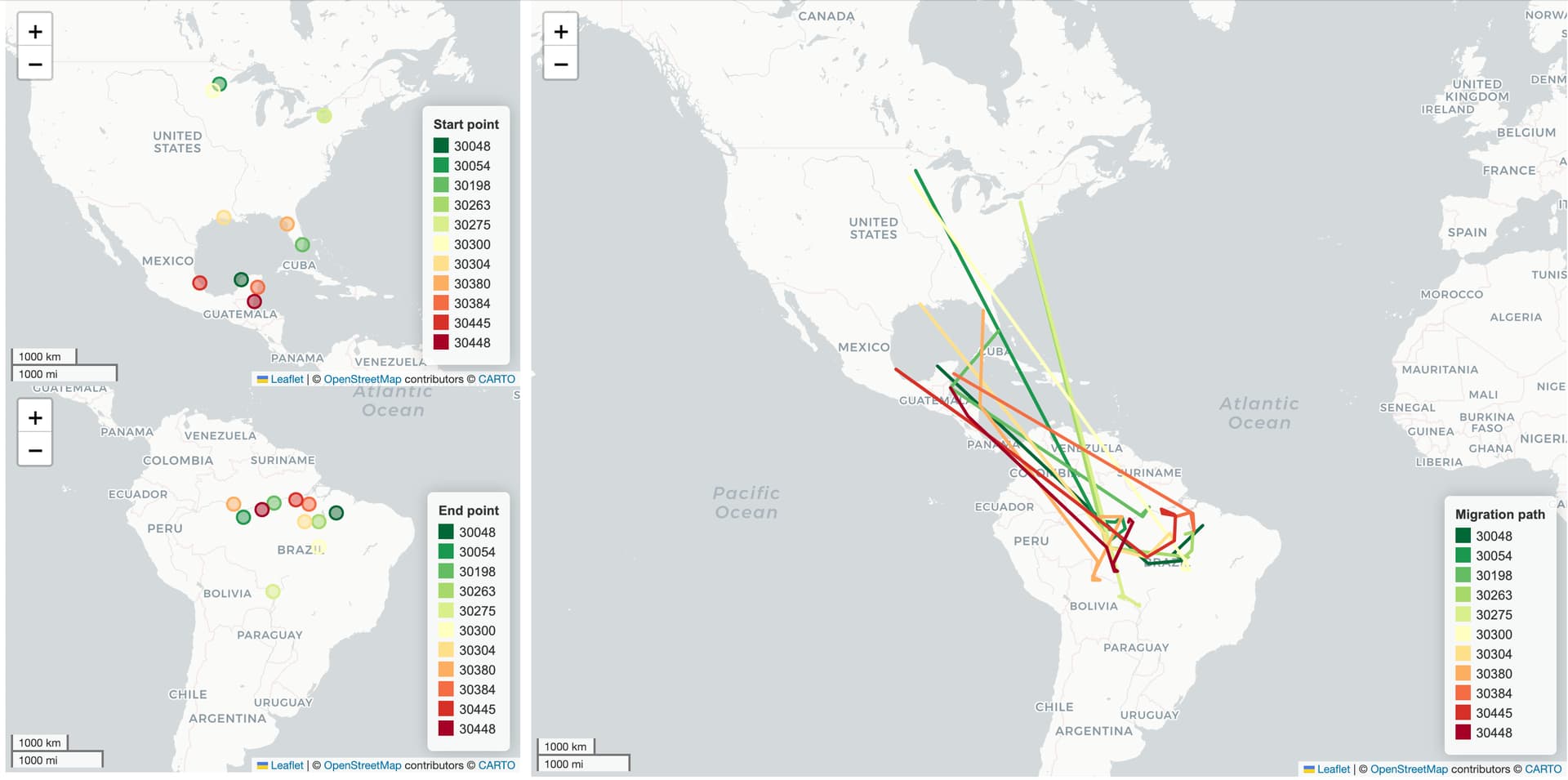
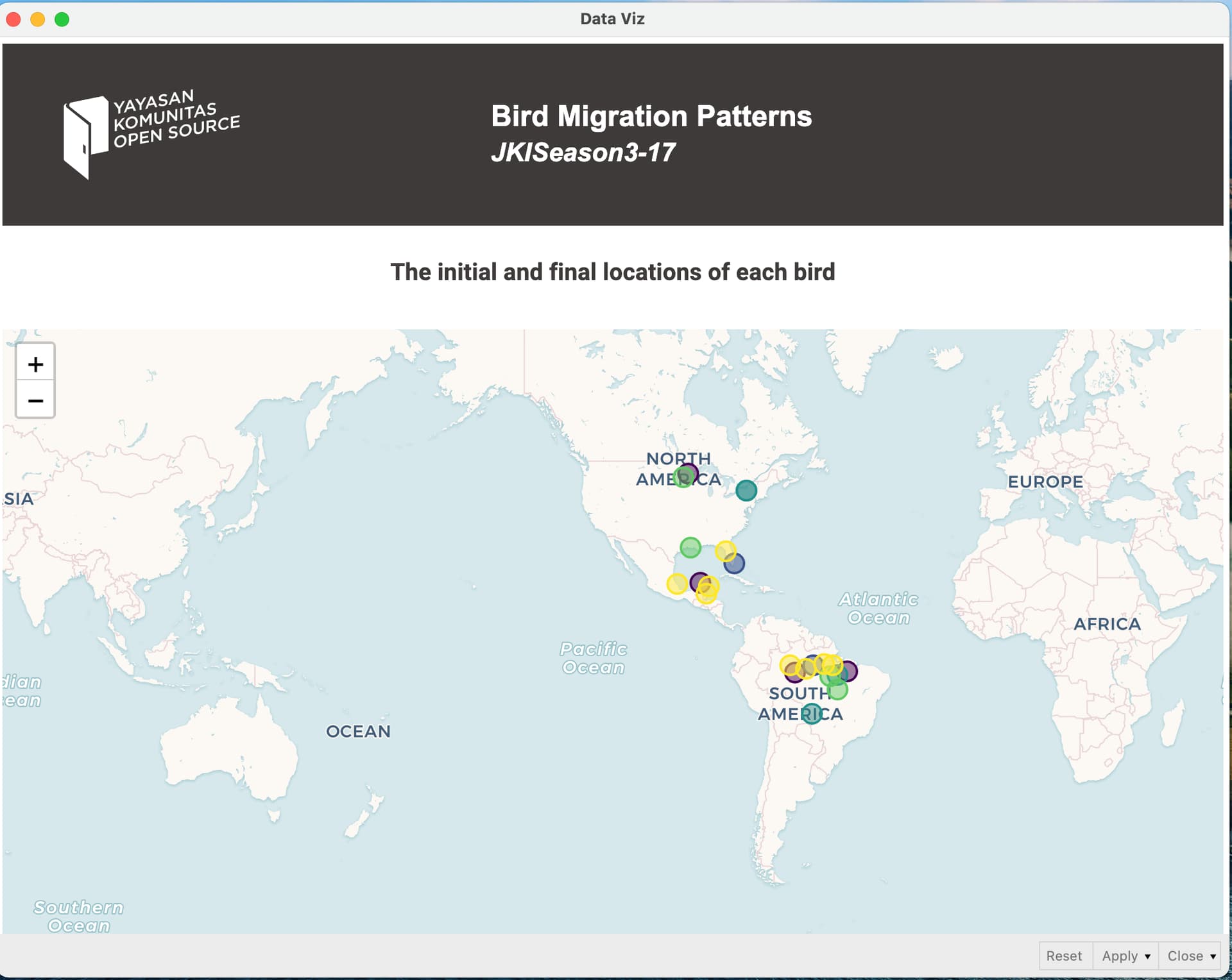
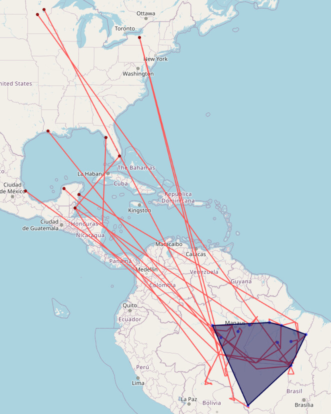
We can definitely say that the birds’ initial place is North and Central America and they are going down to South America! Always fascinated how easy it is to visualize something in KNIME that classically would be very hard in other tools :slight_smile:

6 Likes

Hello, here is my solution for this challenge.

5 Likes

Hello all,
This is my solution.

The tool provides small maps of the starting and ending points on the left and a relatively large map of the migration path of each bird on the right.

6 Likes

Find my Submission -


4 Likes

Here’s my solution. Used UNIX time for Point to Line node serial column.

4 Likes

Well done. Very nice.

4 Likes

Hi @alinebessa :wave: :slightly_smiling_face:

Uploaded my solution for this week’s Just KNIME It! challenge this afternoon, Jakarta time. Feeling excited and ready for feedback! :ninja: :fire:

5 Likes

Hi @alinebessa

Here is my solution. And I learned something new:

  • to have points, lines and polygons objects in one column to display them together on a map
  • to create a boundary around the destination points of the birds in Brasil (but I was wondering is there an easier way to create this).

gr. Hans

5 Likes

Hi all,
Here is my solution.

6 Likes

Hi all,
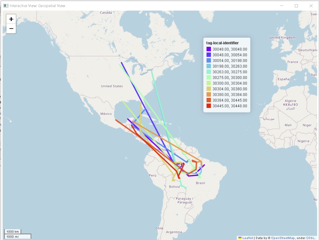
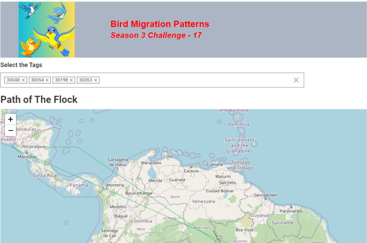
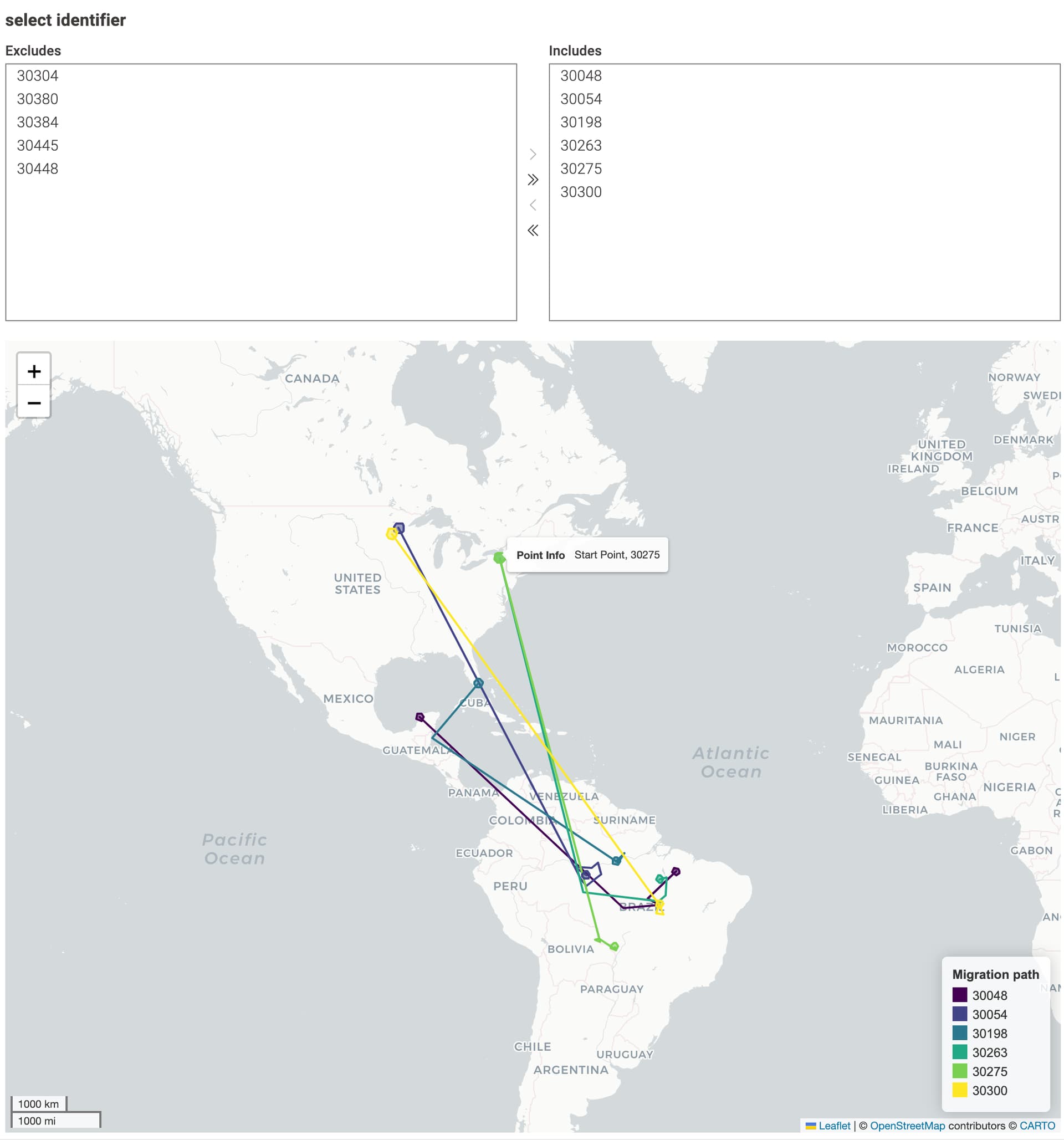
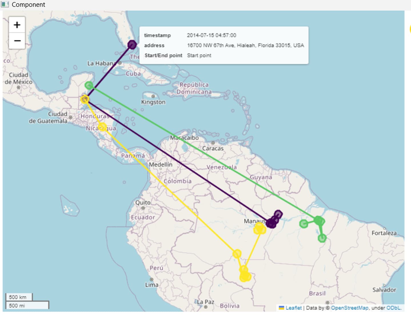
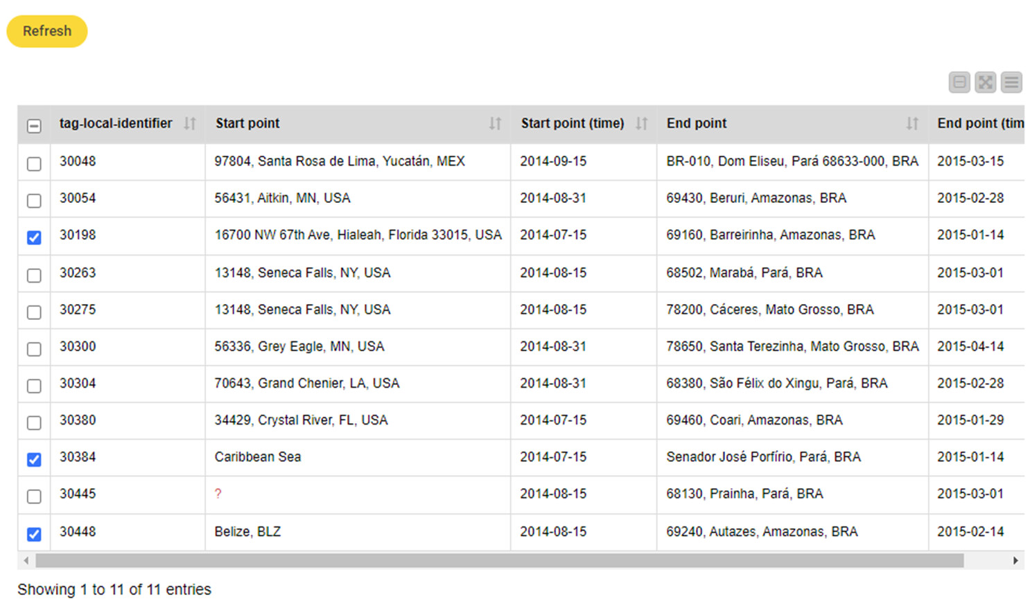
I used reverse geocoding to determine the migration destinations. By selecting the tag-location-identifier in the table view, you can choose the migration route you want to see. Thanks.


6 Likes

Looks great. Where did the nodes for geo coordinates and map viewer come from?

4 Likes

Thanks Rooikat! :slight_smile:

They are part of the Palladian extension:

Latitude/longitude to coordinate: Latitude/Longitude to Coordinate — NodePit

Map viewer:

3 Likes

thank you,for sharing knime tips @berti093

2 Likes

Or this extension : Geospatial Analytics Extension for KNIME – KNIME Community Hub

3 Likes

Here’s my solution

3 Likes

I will look for them. Thank you!

1 Like

I’d favor this one too!

Hello Everyone,
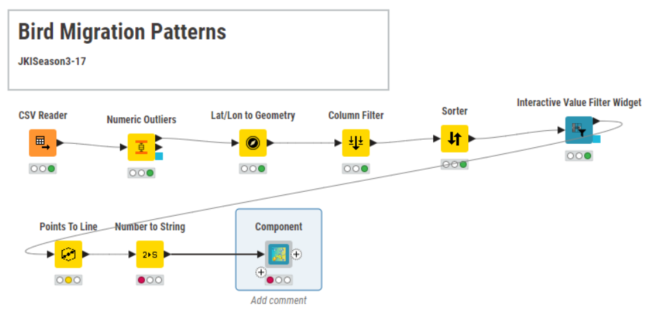
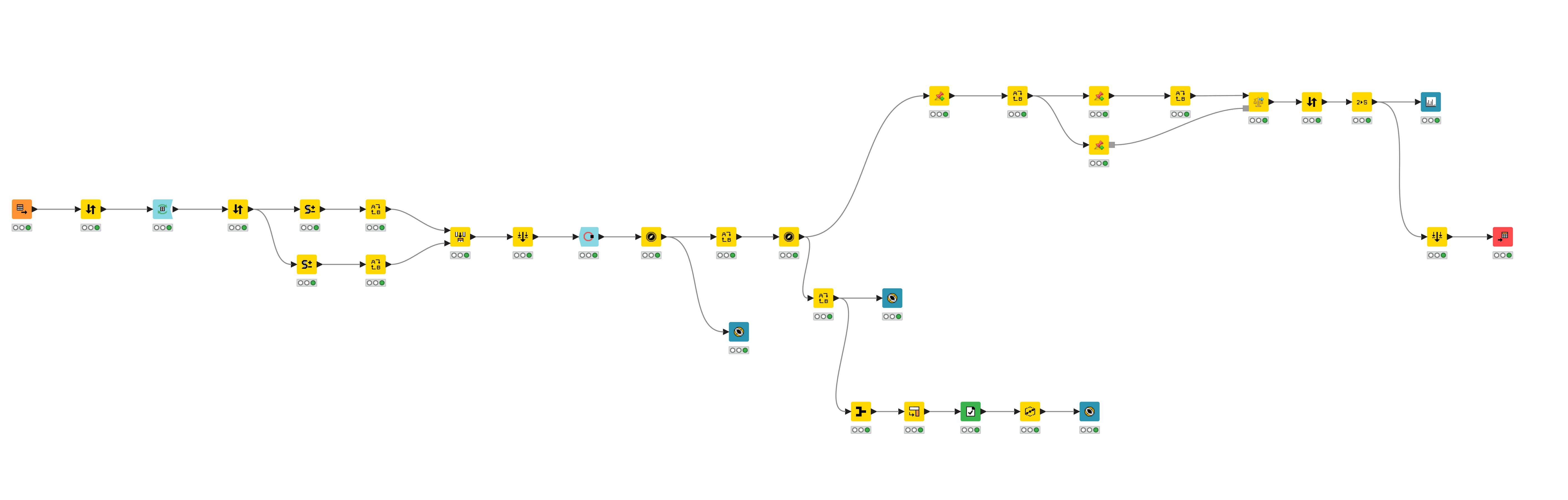
Please find my submission for this week’s challenge.
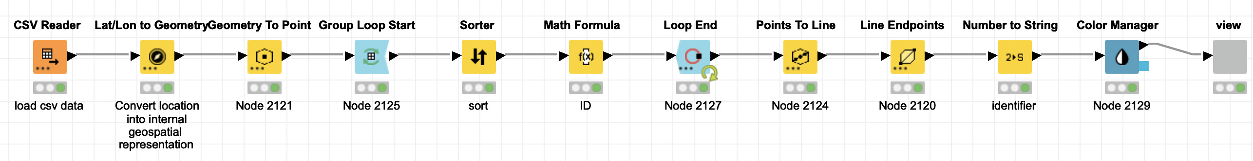
I also took help from some of the solutions posted by other advanced users that helped me understand the concepts associated with Line-To-Point and Convex Hull nodes.

The solution is available at this link below.


Best Regards,
nilotpalc

1 Like

:bird: :baby_chick: 
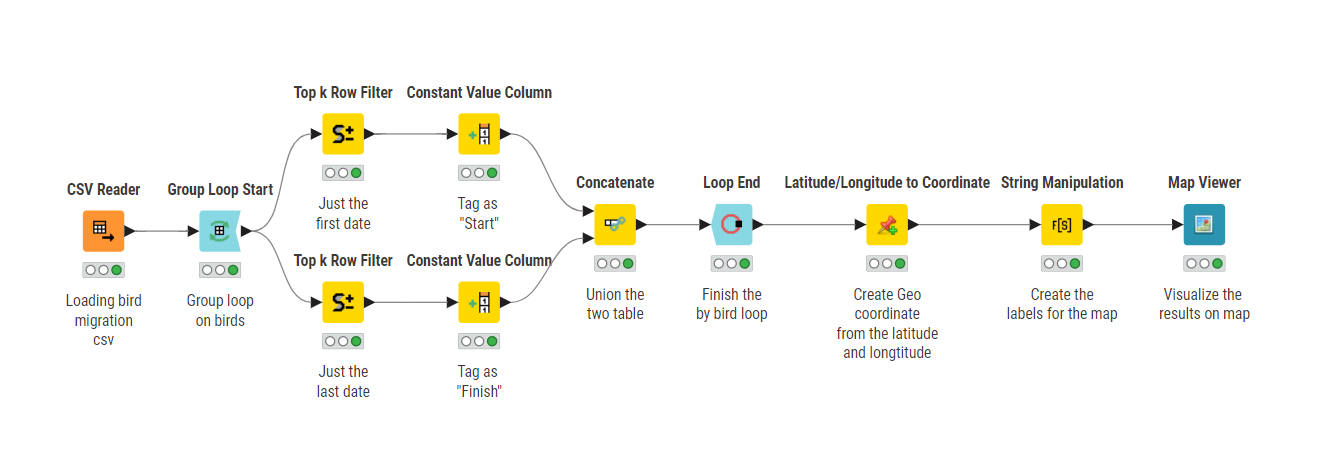
Here’s our solution to last week’s Just KNIME It! challenge!

It looks like the birds (like me!) crave South America in their migrations!

:hugs: Thanks for your really nice submissions that explore the geospatial analytics extension in different ways, and see you tomorrow for a challenge on explainable AI! :brain:

4 Likes