We’re on a roll! This week we’ll tackle yet another topic for the first time: geospatial analytics! Use our Geospatial extension to show us what your favorite place in the world is!
Here is the challenge. Let’s use this thread to post our solutions to it, which should be uploaded to your public KNIME Hub spaces with tag JKISeason2-18.
Need help with tags? To add tag JKISeason2-18 to your workflow, go to the description panel on the right in KNIME Analytics Platform, click the pencil to edit it, and you will see the option for adding tags right there. Let us know if you have any problems!
Here’s my solution. Two maps of my hometown. One based on geocoding the centroid; the other using OSM boundaries. The latter was a little finicky. My town has the same name as the county its located in. OSM defaults to the county boundary. Oddly enough if I just used the town name and USA it works. This seems odd since there are towns in many states with the same name. Regardless, it worked in this case. BTW - I couldn’t figure out how to use a postal code in the OSM node. They work in the OSM API.
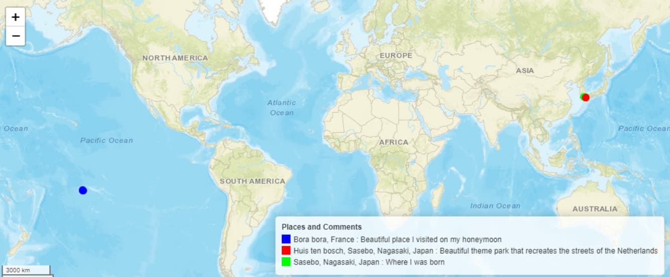
@rfeigel Thank you. It seems that if multiple places are selected that are far enough apart, such as Japan and France, the whole world map is automatically selected.
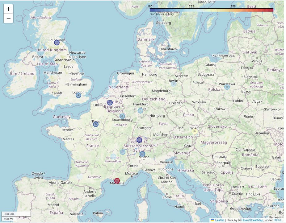
Hello everyone,
Here’s my solution.
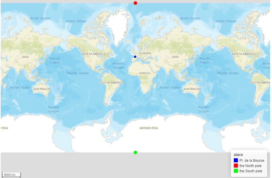
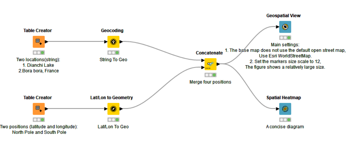
I used @sryu ’s workflow. Thank you, @sryu. In order to display the full world map on execution, the North pole and the South pole were added to the map. They are like thumbtacks. Thanks.
Here is my submission on the challenge… couldnt avoid the zoom for the world view.
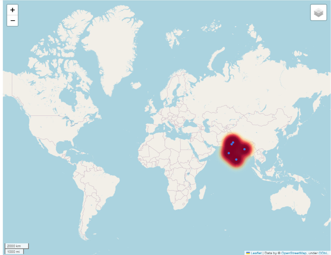
OSM boundry is a good tool while throws many errors especially the region and emenities…Found it has limited content in the Indian subcontinent in many tags … even for tags like tourism … Might have to change the CRS while tried many CRS still shows the few data /no data.
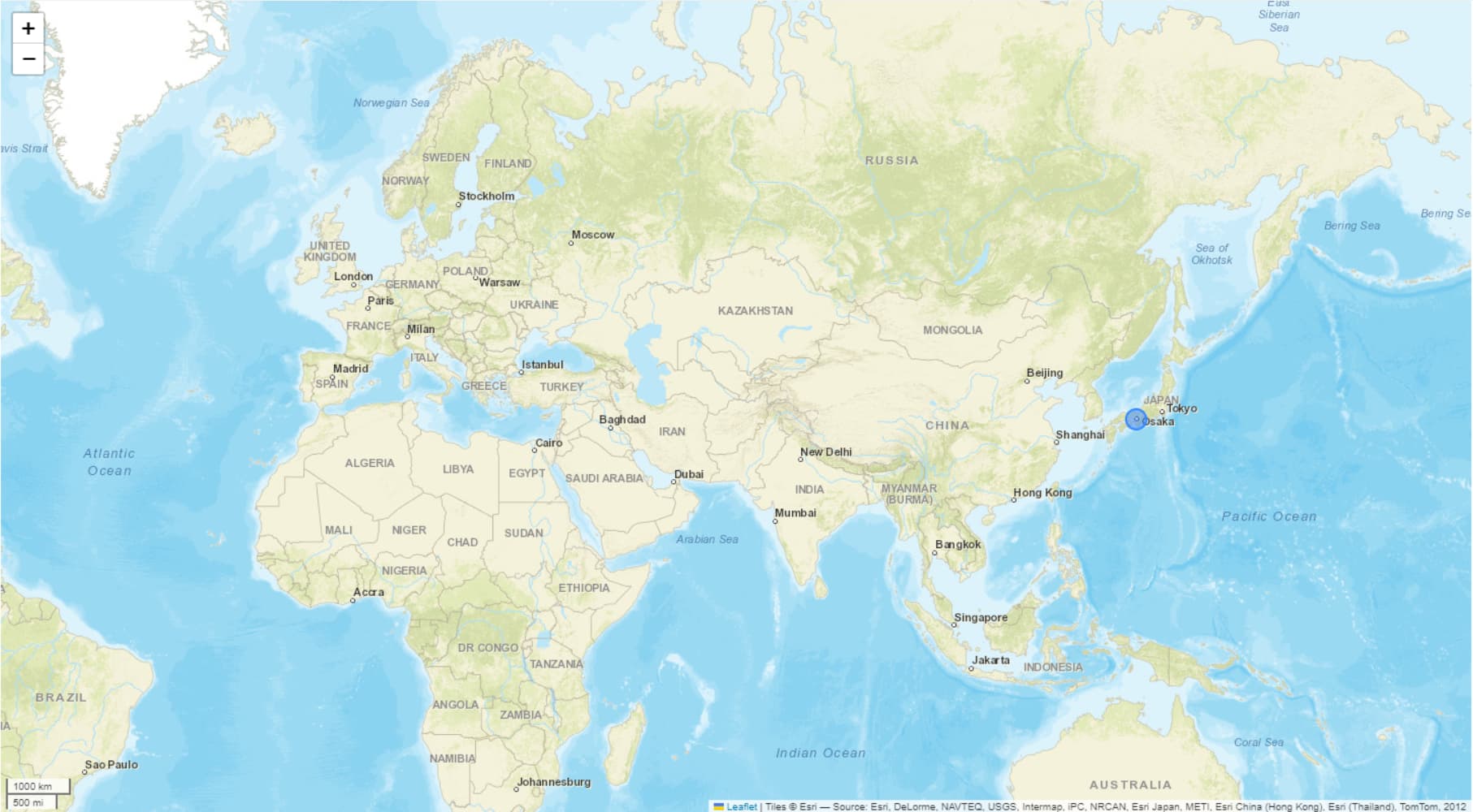
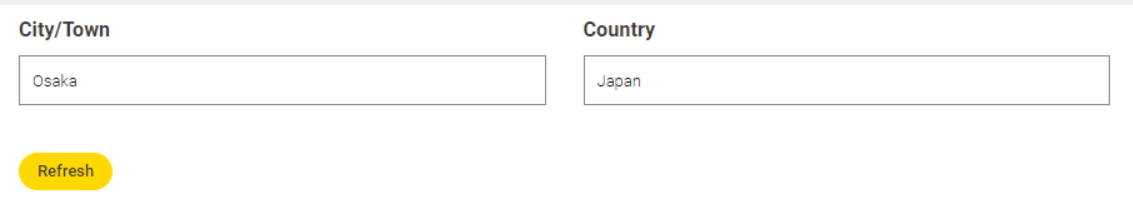
I’ve done something very similar and have tagged the best place I’ve been on holiday (Osaka, Japan) on the map using the -OSM Boundary Map-, -Geometry to Point- and -Geospatial View- nodes:
I added two -String Widget- nodes to allow the user to input the City/Town and the Country, then combined the inputs using the -String Manipulation (Variable)- node:
Here is my solution, thanks to @rfeigel for the example since I have never used Geospatial extension before. Similar to @HeatherPikairos I built an interactive component that show any place user enter to the text bar.
Unfortunately I had troubles with Geospatial View node on Linux, so I used Windows (I have already posted a bug report).
Hi Crazy Knimers
As always, I really enjoyed this challenge. I was able to improve and deepen my knowledge of this topic.
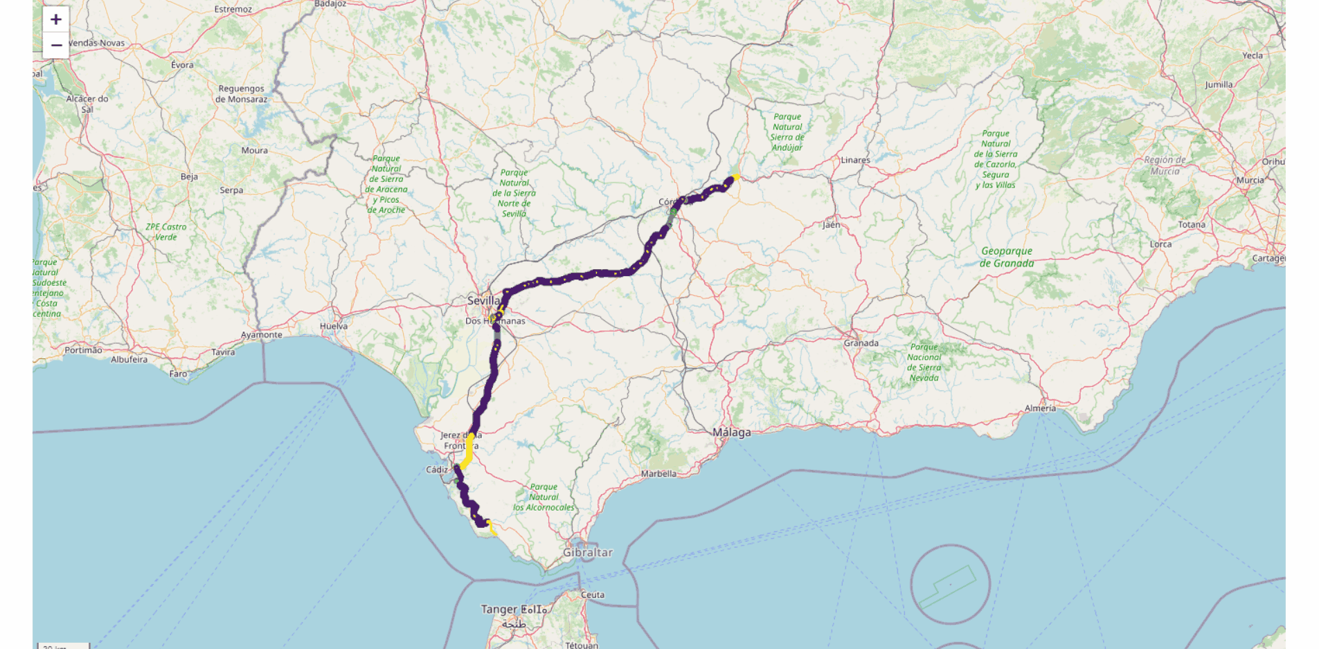
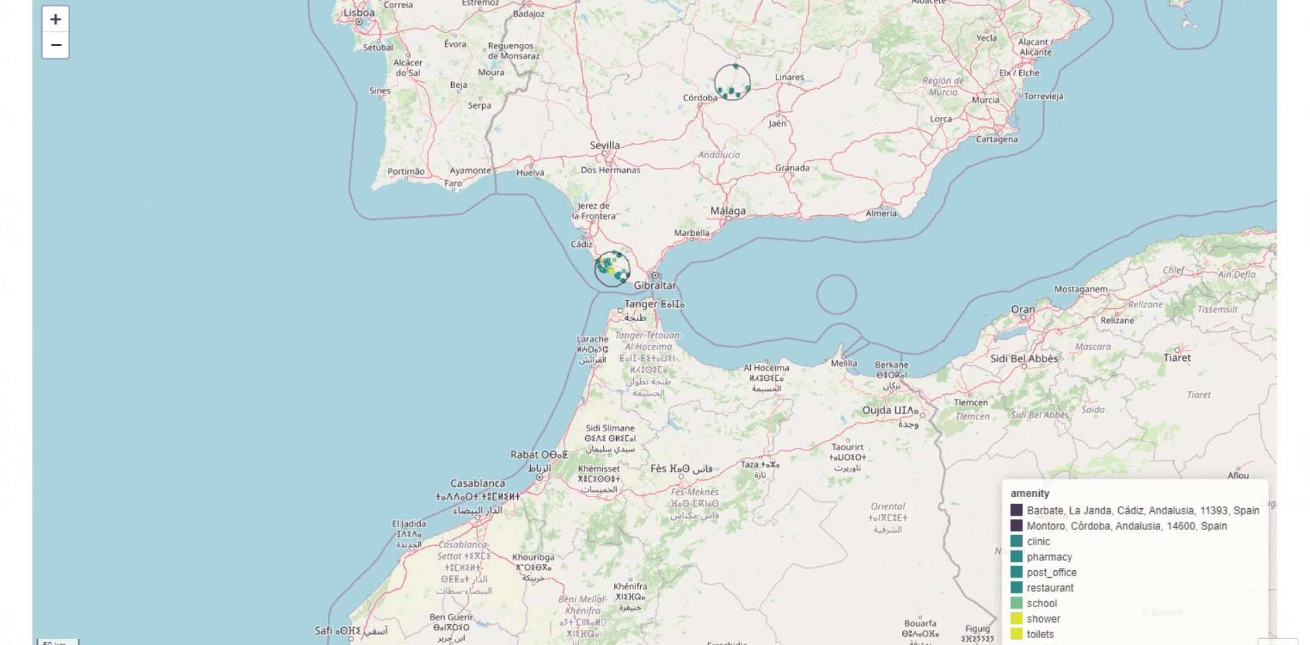
I´m going to show my favourite place to live Montoro and my favourite place to spend my summer holidays, Barbate, both in the south of Spain JKISeason2-18 Ángel Molina – KNIME Community Hub
As a novelty, I have written an article about this challenge. It´s in Spanish but is easy to understand. Descubriendo Andalucía con KNIME: Montoro y Barbate
See you next one
Hello everyone, this is my solution.
This question is indeed a challenge for me, as shown in the figure. I also referenced to and studied the solutions proposed by my previous colleagues. It is worth mentioning that if it is a positional description string (table data), it can be transformed using the “Geocoding” node.
As always on Tuesdays, here’s our solution to last week’s Just KNIME It! challenge
Folks, wasn’t this one super fun? We got to know a bit more about your favorite places! The author of this challenge picked Firenze in Italy, and here’s what the solution looks like:
Once again we’re FLOORED with the quality of your solutions! And we’re so happy to see how comfortable you are with the creation of data apps and composite views! Amazing.
See you tomorrow with a new challenge on a very different topic!