Hi all,
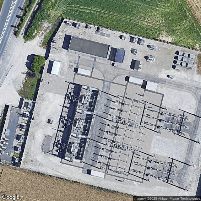
I need to classify satellite images from Google Maps of Power Systems into 2 categories: Air Insulated Switchgear and Gas Insulated Switchgear.
I could manage to create a workflow that downloads ~6000 satellite images of Power Systems from Google Maps.
Now I want to create a deep learning model to classify them. I have labeled 100 images and used this tutorial to the create the model All Cats & Dogs? Classify Images with Codeless CNNs | KNIME
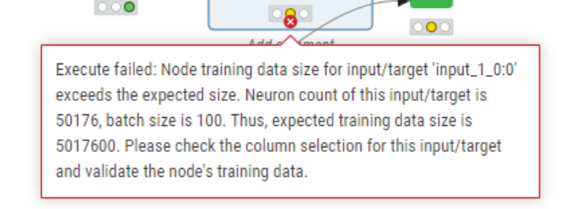
I get an issue at the “Keras network learner” node saying:
I have also seen that we could use and fine tune a pre-trained model like ResNet50 with the “DL Python Network Creator” but don’t have the python code for it, same for Data Augmentation with Python Script.
Can anyone help me with this please? I share the workflows and example of the images.
It would great to either:
- fix the error to have a workflow training and executing the model
- get the python code to use with DL Python Network Creator with a pre-trained model adapted to this task
- I’m also wondering the right number of labeled images, and how we could augment it with Python code
Thanks in advance and best regards
Model training.knwf (92.7 KB)